


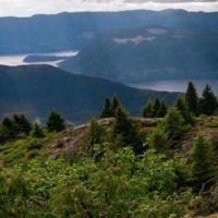
This route showcases some of the most diverse and stunning scenery in Western Canada!
-click Map to expand-
The tour begins in Vancouver, British Columbia or in Banff, Alberta. You may choose to modify the route based on your personal preferences or additional destinations, but overall we think this is the route that offers the best of Western Canada in just 8 to 15 days.
This route is very detailed, with a few major must-sees included. Following our loving crafted itinerary, we're confident you'll have an unforgettable camping experience in Canada. Everyone has unique preferences, styles, and tastes. Some are drawn to the remote wilderness, while others favor well-known national parks like Banff NP and Jasper NP. Families with children will particularly enjoy Wells Gray Provincial Park and the Okanagan region. One of our favorite locations is Yoho National Park, which tends to be less crowded than other spots in the Rockies (such as Lake Louise) but still boasts incredible landscapes. All of these destinations are truly worthwhile.


This warmer Family friendly route is perfect for sunbathing, boating, swimming, and relaxing.
-click Map to expand-
Our alternate options (ALT-Route) offer a more family-oriented experience, encompassing not only the high mountains but also sunny lakes, rivers, and streams. This warmer route offers family-friendly campgrounds, allowing children of all ages to have fun. The Okanagan Valley, a warm wine and fruit region with beautiful, expansive lakes, is perfect for sunbathing, boating, swimming, and relaxing. This route also passes Bromley Rock and Hedley, which are ideal for tubing or rafting along the rivers and streams.
Trip Overview
- Banff National Park (NP)
- Banff NP to Jasper NP
- Jasper NP to Wells Grey Provincial Park (PP)
- Wells Grey to Whistler & Squamish
- Vancouver
- (ALT-Route) - Okanagan Falls to Osoyoos
- (ALT-Route) - Osoyoos to Princeton
- (ALT-Route) - Princeton to Manning Park
- (ADDON-Sunshine Coast) - Powel River & Lund
- (ADDON-Sunshine Coast) - Powel River/Lund to Sechelt
Banff National Park

In the fall of 1883, three Canadian Pacific Railway construction workers stumbled across a cave containing hot springs on the eastern slopes of Alberta's Rocky Mountains. From that humble beginning was born Banff National Park, Canada's first national park and the world's third. Spanning 6,641 square kilometres (2,564 square miles) of valleys, mountains, glaciers, forests, meadows and rivers, Banff National Park is one of the world's premier destination spots.
If you're seeking peace and quiet away from the hustle and bustle of Banff town or Lake Louise, opt to camp in one of the smaller campgrounds situated a bit further out such as Two Jack Lakeside and Main Campgrounds. With shared amenities such as hot showers, these campgrounds offer a more serene experience.
Popular campgrounds in Banff National Park:
There are ten campgrounds in Banff National Park that can be reserved in advance. Of these ten campgrounds, five are located in the Banff town area, while the remaining five are between Johnston Canyon, Lake Louise and the Icefields Parkway. Included in the list are 3 additional campgrounds that are first come first served only.
Please note that there is a fire permit required for all open pit fires in Banff NP which is in addition to your campsite reservation.
Parks Canada Fees List ( Banff NP )
Online reservations for campgrounds in Banff NP can be made here:
-
Tunnel Mountain, Village 1
Banff's largest campground, with over 600 sites, is located just 4 km East of Banff town and offers the option to reserve a campsite. The sites vary widely in quality, with some being secluded and others boasting beautiful views. While some spots are really nice, others may be less desirable due to the proximity of facilities, or the main road.
Facilities at the campground include well serviced washroom buildings with flush toilets and showers, as well as a dump station, fire pits, firewood, and a public bus stop to the town. However, there are no electricity or sewage hook-ups available.
The campground is open from the middle of May till the first week of October, depending on the weather.
-
Tunnel Mountain, Village 2
This campground boasts 188 sites, each equipped with electrical hook-ups. Although it can be partly reserved, its smaller size means it tends to be very busy. It's conveniently situated just 2.4 km from Banff town, making it an attractive option for visitors.
Facilities at this campground include electricity but no sewage hook-up. There are well-maintained washroom buildings with flush toilets and showers, as well as a dump station. Visitors should note that while open campfires are not permitted on the site, fires can be made in the camp shelters' stoves.
This campground is open year-round, allowing visitors to enjoy its serene surroundings and natural beauty no matter the season.
-
Tunnel Mountain, Trailer Court
This campground is perfect for trailers, RVs, and motorhomes, with 321 sites and full hook-ups available. The campsites can accommodate units up to 50 feet in length and can be reserved in advance. However, due to its excellent facilities, this campground is often very busy.
Facilities at this campground include full hook-ups, good washroom buildings with flush toilets and showers, and a dump station. Visitors should note that open campfires are not permitted on the site, but fires can be made in the stoves provided in the camp shelters.
The campground is open from the middle of May till the first week of October, weather permitting.
-
Two Jack, Main
This quiet campground offers 380 sites and is a great choice for visitors looking to enjoy the natural beauty of Banff without the hustle and bustle of the town. It is situated 13 km east of Banff, on the scenic Minnewanka Lake loop drive, where wildlife is abundant. The campground offers lots of space between campsites, but if you can secure a spot at the Two Jack Lakeside, it's worth trying first.
Facilities at this campground include flush toilets, a dump station, and fire pits. However, there are no showers available on-site.
The campground is open from late June to early September, weather permitting.
[ NOTE: Cell phone coverage may be sparse. ]
-
Two Jack, Lakeside
This small, peaceful campground offers only 74 sites and is the perfect choice for visitors seeking a quiet and beautiful location near Banff. Situated on the shore of Two Jack Lake, it offers stunning views of the surrounding mountains and lake. It is a great spot for hiking, fishing, canoeing, and wildlife viewing.
. Facilities at this campground include flush toilets, showers, a dump station, and fire pits, providing everything you need to explore Banff while staying in a tranquil setting.
The campground is open fromthe middle of May till the first week of October, weather permitting.
[ NOTE: Cell phone coverage may be sparse. ]
-
Johnston Canyon Campground
Johnston Canyon campground is a beautiful and remote camping destination located on the Bow Valley Parkway (Highway 1A) in Banff National Park, Canada. The campground offers 132 sites and is situated next to the Johnston Creek, offering stunning views of two nearby waterfalls and abundant wildlife.
Facilities at Johnston Canyon campground include flush toilets, showers, dump station, and fire pits, making it a comfortable and convenient option for visitors. However, it is important to note that there are no hookups available for RVs or trailers.
The campground is located 25 km west of Banff and is open from late May to late September, depending on the weather. While it offers a beautiful and remote camping experience, visitors should be aware that it can be quite busy and noisy, especially during peak season. The sites are quite close together, so privacy may be limited.
[ NOTE: Cell phone coverage may be sparse. ]
-
Castle Mountain [ Closed until further notice ]
This small campground located 31 KM's west of Banff town, on the Bow Valley Parkway (Highway 1A) offers 43 sites in a stunning scenic area. This is an excellent location to camp for a few days and explore most of Banff National Park, especially if you prefer to stay in one place rather than move around every day. Spend a day or two hiking in Banff, which is only a 30-minute drive away, and another day or two in Lake Louise, where you can enjoy the great trails of Castle Mountain.
Facilities at Castle Mountain campground include flush toilets and fire pits, but unfortunately, there are no showers available.
The campground is open from mid May to late September, depending on the weather.
[ NOTE: Closed until further notice by Parks Canada ]
-
Protection Mountain Campground
Located on the Bow Valley Parkway (Highway 1A) 15 km east of Lake Louise, this remote and basic campground offers 89 sites. Similar to Castle Mountain, this campground is a strategic location to explore Banff National Park without having to move your campsite.
Facilities available at this campground include flush toilets and fire pits, but unfortunately, there are no showers.
The campground is open late mid June to early September, on a first come first served basis. No reservations are available.
[ NOTE: Cell phone coverage may be sparse. ]
-
Lake Louise Campground (Soft-sided)
The campground is situated 5KM's from the iconic Lake Louise, offerring visitors breathtaking views of the lake and the surrounding mountains. The campground is an excellent option for those looking to camp in a tent-only campground. The campground boasts 206 sites and is surrounded by an electric fence built by Parks Canada to protect campers from the numerous grizzly bears in the area.
The campground offers a range of facilities, including flush toilets, hot and cold water on tap, hot showers, kitchen shelters, fire rings with firewood provided, recycling bins, and food storage facilities. The facilities are well-maintained and provide campers with all the necessary amenities.
The campground is open late early June to late September, depending on the weather.
-
Lake Louise Campground (Hard-sided)
The campground is situated 5KM's from the iconic Lake Louise, offerring visitors breathtaking views of the lake and the surrounding mountains. This campground is designed for trailers, RVs, and motorhomes, and has a total of 189 sites during the summer period and 30 sites in the winter, making it open year-round.
The campground offers a range of facilities, including electric hook-ups, well-maintained washroom buildings with flush toilets and showers, and a dump station. It's worth noting that all of these amenities are available year-round.
The campground is open year round, reservations are available between mid May to end of September.
-
Mosquito Creek Campground
This campground is situated at the foot of Mount Hector, offering breathtaking views. It has a total of 32 sites and is located 24 km northwest of Lake Louise on the Icefields Parkway. The campground's proximity to Helen Lake, Crique Peak, and Bow Peak make it an ideal location to explore the area. A top hiking tip is to check out the Helen Lake Trail, which is one of the best hikes in Banff National Park.
Facilities at this campground include dry toilets, well water accessed via a hand pump, a kitchen shelter equipped with a wood cook stove, and fire rings with firewood provided.
The campground is open early June to early October, on a first come first served basis. No reservations are available.
[ NOTE: There is no cell phone coverage at any campgrounds on the Icefields Parkway ]
-
Waterfowl Lakes Campground
This mid-sized campground has a total of 116 sites and is located on the Icefield Parkway, 57 km northwest of Lake Louise. The campground is situated in a stunningly beautiful area surrounded by trees, the river, and Waterfowl Lake. There is also a great open area towards the lakefront that's perfect for playing games or simply enjoying the scenery.
Facilities at this campground include flush toilets, a Sani-dump station, and fire pits for campfires. It's important to note that there are no shower facilities available at this campground.
The campground is open late June to early October, on a first come first served basis. No reservations are available.
[ NOTE: There is no cell phone coverage at any campgrounds on the Icefields Parkway ]
-
Silverhorn Creek Campground
Silverhorn Creek is an RV-friendly campground offering a rustic camping experience along the Icefields Parkway, just minutes from Waterfowl Lakes, Bow Lake, and the Peyto Lake viewpoint.
Facilities at this campground include dry toilets, and fire pits for campfires. It's important to note that there is no running water, or shower facilities available at this campground. Campsites are unserviced and best suited for tents, or motorhomes and trailers up to 20 meters (70 feet). RV campers can fill with potable water and use the sani-dump station located at Waterfowl Lakes campground.
The campground is open early June to late September, reservations are available for theses dates.
[ NOTE: There is no cell phone coverage at any campgrounds on the Icefields Parkway ]
-
Rampart Creek Campground
The Rampart Creek Campground is a small campground with only 50 sites. It's situated near the Columbia Icefields and is close to the Saskatchewan River Crossing. The campground is a great choice for those who prefer a quieter camping experience. This campground is often used as a base-camp for local mountaineering pursuits.
Facilities at this campground include running water, dry toilets, cook shelters, and fire pits for campfires. It's important to note that there are no shower facilities available at this campground. Campsites are unserviced and best suited for tents, or motorhomes and trailers up to 10 meters (35 feet). Note that some loops are not suitable for motorhomes or trailers over 8 meters (25 feet). RV campers can fill potable water and use the sani-dump station located at Waterfowl Lakes Campground.
The campground is open early June to late September, reservations are available for theses dates.
[ NOTE: There is no cell phone coverage at any campgrounds on the Icefields Parkway ]
The Icefields Parkway & Jasper National Park

The Icefields Parkway is considered one of the most spectacular drives in the world. Also known as Highway 93 North, it stretches from Lake Louise to Jasper. Every inch of the drive offers breathtaking scenery, so be sure to take your time and enjoy it. The drive is long and takes around 4-5 hours without stops. Our advice is to plan a full day or even a couple of days for it. We highly recommend experiencing some of the fantastic day-hikes along the Icefields Parkway.
To get the most out of your experience, try to leave early in the morning to catch a glimpse of the local wildlife, such as grizzly bears, elk, mountain goats and moose grazing along the way. We suggest hitting the road by 7 am to increase your chances of spotting these magnificent creatures.
Campgrounds along the Icefields Parkway / Jasper National Park:
The following campgrounds are managed and maintained by Parks Canada, and their opening dates and rates vary depending on available facilities.
It's important to note that there are three campgrounds that are designated as tent-only: Columbia Icefields, Snaring River, and Jonas Creek. Even during the high season, it's usually possible for tenters to find a spot at a campground, although you may end up in the overflow site.
If you're looking for a hot shower, you'll need to visit Whistler, Wabasso or Wapiti Campground. The best chance of securing a spot without a reservation is at Wapiti as there are 322 tent-only sites available. It is important to arrive on time (before 2pm) to ensure a spot for the night.
Please note that there is a fire permit required for all open pit fires in Jasper NP which is in addition to your campsite reservation.
Parks Canada Fees List ( Jasper NP )
Online reservations for campgrounds in Banff NP can be made here:
-
Wilcox Creek Campground
A nice tent-only campground with 46 sites at the entrance of Jasper National Park. Wilcox Creek campground is close to the Columbia Icefield, which is ideal for longer visits to the Columbia Icefields. It is also a great location if you plan to hike the Nigel Pass trail and the Parker Ridge trail, or even the Wilcox Pass/Peak trail. Note that it can get pretty cold in this area of the Rockies. Compared to other campgrounds, it is laid-back and not too busy.
Facilities at the campground include piped water, dry toilets, camp kitchen with a wood stove, fire pits and picnic tables. Fire wood is available with a permit.
The campground is open from the middle of June till the middle of September, on a first come first served basis. No reservations are available.
[ NOTE: There is no cell phone coverage at any campgrounds on the Icefields Parkway ]
-
Columbia Icefields Campground
This campground is situated close to Columbia Glacier and offers stunning views of the surrounding mountains and glacier (the views are even better than those at Wilcox Creek Campground). It's a small but popular campground with only 33 sites, so you'll need to arrive early to secure a spot. Like Wilcox Creek, it can get pretty cold, but it's a great location if you plan on hiking the nearby Icefield trails (such as Nigel Pass, Parker Ridge Trail, or Wilcox Pass) or just want to enjoy the views (including the stars at night). This campground is mostly used by mountaineers who are climbing in the area.
Facilities at the campground include piped water, dry toilets, camp kitchen with a wood stove, fire pits and picnic tables. Fire wood is available with a permit.
The campground is open from the middle of June to early October, on a first come first served basis. No reservations are available.
[ NOTE: There is no cell phone coverage at any campgrounds on the Icefields Parkway ]
-
Icefields Centre RV
This RV campground is located in a prime location for visiting the Icefields in the Canadian Rockies. This is a large asphalt parking lot located on the west end of the Icefields Visitors Centre. There are 100 sites lined out on the asphalt. A convenient option for those looking to explore the nearby attractions.
Facilities: there is no water, services or firepits here but there are dry toilets.
The campground is open from the middle of May to early October, on a first come first served basis. No reservations are available.
[ NOTE: There is no cell phone coverage, but the Icefields Centre has Public WiFi. ]
-
Jonas Creek Campground
Small, quiet campground located along the babbling Jonas Creek with only 25 sites available on a first-come, first-served basis. Adventurous campers looking to get away from it all can also walk into hillside sites secluded in the forest. In addition, a bike camping area can be found near the cooking shelter, offering a great stop-over option for cyclists tackling the length of the Icefields Parkway.
Campsite #14 is designated for bike camping only. This is a shared site for unsupported bike touring and can accommodate 10 tents.
Facilities at this campground include dry toilets, potable water, sheltered camp kitchen with a wood burning cook stove, fire pits, garbage bins and bear proof food storage lockers. Campsites are unserviced and best suited for tents, or motorhomes and trailers under 8m (25 feet).
The campground is open early June to early September, on a first come first served basis. No reservations are available.
[ NOTE: There is no cell phone coverage at any campgrounds on the Icefields Parkway ]
-
Honeymoon Lake Campground
The Honeymoon Lake campground is located on the picturesque west shore of Honeymoon Lake. With 35 campsites available, this campground is best suited for tents and smaller RVs. The views from the sites are breathtaking, overlooking both the crystal-clear lake and the stunning Endless Chain Ridge. Canoeing on the lake is a popular activity, and nearby Buck Lake and Osprey Lake are just a short hike away. The stunning Sunwapta Falls, Athabasca Falls, and Mount Edith Cavell are all located just a short drive north of the campground.
Facilities include picnic tables, a public pay phone, potable water, dry toilets, a sheltered camp kitchen equipped with a wood-burning cook stove, garbage bins, bear-proof food storage lockers, a canoe launch, and fire pits.
Campsite #24 is designated for bike camping only. This is a shared site for unsupported bike touring and can accommodate 6 tents.
The campground is open from mid May to mid September, on a first come first served basis. No reservations are available.
[ NOTE: There is no cell phone coverage at any campgrounds on the Icefields Parkway ]
-
Mount Kerkeslin Campground
Located along the Athabasca River, Mount Kerkeslin Campground is just a short drive from the iconic Athabasca Falls. The campground is nestled in a serene forest of mature spruce and fir trees, offering 42 campsites. While there are spots for RVs, this campground is best suited for tenters and those with small RVs. The stunning views of Mount Fryatt to the south make for a picturesque setting. A sandy area by the Athabasca River is a great place to relax and soak up the scenery, but it is not recommended for young children as the river flows fast and deep. As a bonus, this campground is a prime spot for stargazing and boasts a Bortle Scale ranking of #1-2 for night skies.
Facilities include picnic tables, a public pay phone, potable water, dry toilets, a sheltered camp kitchen equipped with a wood-burning cook stove, garbage bins, bear-proof food storage lockers and fire pits.
The campground is open from late May to early September, on a first come first served basis. No reservations are available.
[ NOTE: There is no cell phone coverage at any campgrounds on the Icefields Parkway ]
-
Wabasso Campground
Wabasso Campground features 228 campsites, divided into 4 loops and a section exclusive for tents. Some of the sites have a scenic view of the Athabasca River, offering an expansive vista of the valley. However, the campsites are in close proximity to each other, providing little to no privacy. The forest in the area appears strained with scarce regrowth, presenting a barren aspect. The Mountain Pine Beetle infestation has also taken its toll by decimating all the local pine trees. The stunning Mount Edith Cavell is located nearby and offers multiple scenic hikes. Wabasso Campground is an excellent home base for visitors looking to explore Jasper and its surroundings for a few days. As a bonus, this campground is a prime spot for stargazing and boasts a Bortle Scale ranking of #1-2 for night skies.
To see pictures of the ongoing regeneration work taking place at some of these campgrounds, view the photo gallery here.
The campground is equipped with a large range of facilities such as picnic tables, water stations, flush toilets, power outlets, sheltered camp kitchens complete with wood burning cook stoves, playground, garbage containers, recycling bins, sani dump, and fire pits.
The campground is open from late May to early September.
[ NOTE: There is no cell phone coverage at any campgrounds on the Icefields Parkway ]
-
Wapiti Campground
A true home base for exploring Jasper National Park can be found at Wapiti Campground, one of the largest campgrounds in the area with 644 campsites. While it can get crowded during peak season, the vast size of the campground makes it fun to explore by bike. In fact, it's only a 3km bike ride to the small town of Jasper, which can be easily explored on foot in a morning or afternoon.
Wapiti Campground offers more trees and privacy between campsites than nearby Whistlers Campground. From here, there are many nearby attractions worth exploring such as Patricia Lake, Pyramid Lake, Lac Beauvert, Maligne Lake, Maligne Canyon, Medicine Lake, Mount Edith Cavell, Lake Edith, Lake Annette, Hanging Valley, Jasper Park Lodge, and Miette Hot Springs. Additionally, the Jasper Tramway up Whistlers Mountain is located a few kms away. You can ride the tram almost to the top of Mount Whistler then hike another 200ms to the summit. As a bonus, this campground is a prime spot for stargazing and boasts a Bortle Scale ranking of #1-2 for night skies.
The campground is equipped with a large range of facilities such as electricity, hot showers, flush toilets, sani dumps, interpretive programs, camp kitchens and fire pits.
The campground is open from mid May to early October.
[ NOTE: Cell phone coverage may be sparse. ]
-
Whistlers Campground
Whistlers Campground is one of the largest campgrounds in Jasper National Park containing 604 campsites. The neighboring Wapiti Campground has many more trees, offerring a bit more shelter. Expect crowds of people and little privacy during peak season. This being said, the size of the campground makes it fun to explore by bike. It's also only a 3km bike ride to the town of Jasper.
From here, there are many nearby attractions worth exploring such as Patricia Lake, Pyramid Lake, Lac Beauvert, Maligne Lake, Maligne Canyon, Medicine Lake, Mount Edith Cavell, Lake Edith, Lake Annette, Hanging Valley, Jasper Park Lodge, and Miette Hot Springs. Additionally, the Jasper Tramway up Whistlers Mountain is located a few kms away. You can ride the tram almost to the top of Mount Whistler then hike another 200ms to the summit. As a bonus, this campground is a prime spot for stargazing and boasts a Bortle Scale ranking of #1-2 for night skies.
The campground is equipped with a large range of facilities such as electricity, hot showers, flush toilets, sani dumps, interpretive programs, camp kitchens and fire pits.
The campground is open from early May to early October.
[ NOTE: Cell phone coverage may be sparse. ]
-
Snaring River Campground
The Snaring River campground boasts 66 campsites, with 56 of them featuring a wood-framed gravel tent pad that accommodates both an RV and a tent. The remaining 10 sites are designated solely for walk-in tents. The riverfront sites offer stunning views of the valley and the Celestine Lake 27km trail is easily accessible from the campground. The Montane Grasslands that surround the area are home to robust populations of Elk, Mule Deer, Black Bears, and Coyotes. Snaring River campground is an excellent home base for visitors looking to explore Jasper and its surroundings for a few days. As a bonus, this campground is a prime spot for stargazing and boasts a Bortle Scale ranking of #1-2 for night skies.
Facilities at the campground include potable water, dry toilets, camp kitchen with a wood stove, fire pits and picnic tables.
The campground is open from mid May to late September, on a first come first served basis. No reservations are available.
[ NOTE: Cell phone coverage may be sparse. ]
-
Miette (a.k.a. Pocahontas) Campground
Miette (formerly know as Pocahontas) Campground features 140 campsites ideal for tents and smaller RVs, arranged in five separate loops. A number of these sites provide views of Mosquito Creek. Additionally, there are 5 charming walk-in tent sites located at the eastern end of the campground, complete with food lockers.
Punch Bowl Falls and the Old Pocahontas Mine are a brief walk away, offering stunning vistas of the surrounding valley. For those interested in relaxation, Miette Hot Springs is a short drive up the Fiddle Valley to the east and is the hottest hot spring (54C) in the Canadian Rockies. Visitors can also explore nearby hiking trails and catch glimpses of the abundant local wildlife. As a bonus, this campground is a prime spot for stargazing and boasts a Bortle Scale ranking of #3 for night skies.
Facilities include picnic tables, water stations, flush toilets, sheltered camp kitchens complete with wood burning cook stoves, disability access, disability campsites, garbage containers, recycling bins, fire pits and interpretive programs.
The campground is open from mid June to early September.
[ NOTE: Cell phone coverage may be sparse. ]
Wells Gray Provincial Park

As you depart from Jasper National Park, you will enter Mount Robson Provincial Park, located at the western edge of the Canadian Rockies. Along the way, you will encounter the highest peak in the area, Mount Robson, which towers at an impressive height of 3,954 meters (12,972 feet) above sea level. If you travel a few hours to the south-west, you will reach Clearwater, which serves as the gateway to Wells Gray Provincial Park, situated in the neighboring Caribou Mountain Range.
Wells Gray Provincial Park
Wells Gray Provincial Park is the fourth-largest Provincial Park in British Columbia, situated 130 km north of Kamloops. Wells Gray Park is one of our favorite places, offering a wide range of activities and attractions. This region offers a truly different feel from the large national parks to the east.
Visitors can enjoy majestic views from the volcanic cone of Pyramid Mountain, explore the magical Easter Bluffs or visit the famous Helmcken Falls. There are numerous trails throughout the park, leading to waterfalls or creeks, making it a great spot for hiking enthusiasts. Wells Gray Park was named after Arthur Wellesley Gray, the Minister of Lands for British Columbia from 1933 to 1941, and was created in 1939.
During the early glacial periods, high volcanic activity caused the ice above to melt, resulting in occasional explosions that formed a rare and jagged landscape. Unstable layers of soft lava helped form rugged canyon-valleys with impressive waterfalls. Rivers eroded the unstable layers further, resulting in the deep, narrow gorges found throughout the park. The park is also home to five deep lakes, carved by the flowing ice.
Wells Gray Provincial Park boasts high mountains, waterfalls, pristine forests, thundering rivers, deep lakes, abundant wildlife and plants. The park protects a vast diversity of landscapes and eco-systems, with over 56 species of mammals, over 200 species of birds, and over 700 species plants. Wildlife enthusiasts can spot caribou, mule deer, moose, mountain goat, black bear, grizzly bear, weasels, pine martens, mink, wolverine, beavers, and coyotes in the park. Water sport is a popular activity in the park, with five large lakes (Clearwater, Mahood, Azure, Murtle, and Hobson), two large river systems, and numerous small lakes, waterways, rapids, streams, and waterfalls to explore.
Directions to Wells Gray Provincial Park
The Clearwater Valley Road, also known as Wells Gray Park Road, is the most frequently used road by visitors to Wells Gray Provincial Park. It starts at the junction of Highway 5 and Clearwater Valley Road in Clearwater and extends 70 km north to Clearwater Lake within the park. The highway exit is clearly marked.
There are two additional roads to access Wells Gray Park:
- From 100 Mile House to Mahood Lake: This is a gravel road, and to get to it from the east, you first have to travel up to 100 Mile House, which is quite a distance.
- From Blue River to Murtle Lake: This road is also a gravel road, leading to the parking lots at Murtle Lake. From there, it's a 1.6 km hike to the campgrounds, where vehicles are not allowed. Murtle Lake is renowned as one of the most stunning wilderness lakes in British Columbia, and those interested in camping there must stop by Blue River to obtain a camp permit.
The Clearwater Valley Road is paved until the Helmcken Falls Junction, located approximately 43 km from Highway 5. It's important to note that the Park itself is not home to any full-time residents and there are no grocery stores or gas stations after the Yellowhead Highway junction. However, you can find amenities in Clearwater before you enter. Along Clearwater Valley Road, there are restaurants and motel/lodges for your convenience.
Upon arrival at the Highway 5 and Clearwater Valley Road junction, it's recommended that you stop at the Wells Gray Information Centre. Here, you can purchase detailed topographic maps of Wells Gray Provincial Park and get up-to-date information about the condition of roads, trails, and campgrounds.
Wells Gray Provincial Park Campgrounds
Wells Gray Provincial Park has four provincial campgrounds that are accessible by car from the Clearwater Valley Road. All campsites and group sites require reservations. When reservations are not available, campsites are allocated on a first-come, first-served basis.
Online reservations for campgrounds in Wells Gray Provincial Park can be made here:
-
Mahood Lake Campground
Mahood Lake Campground is serene and family-friendly destination with ample opportunities for fishing. Unlike other lakes in Wells Gray, Mahood Lake is not glacier-fed and therefore, warms up enough for enjoyable swimming. The lake is ideal for fishing and fly-fishing in local streams. The area also boasts a playground, a swimming beach, a boat launch, hiking trails, and waterfalls. This 34 site frontcountry campground can be accessed by a few different routes.
Accessed either via 88 km of paved and gravel roads from 100 Mile House and along the south shore of Canim Lake, or via 65 km of gravel road from the Interlakes corner on Hwy #24.
Facilities at the campground include piped water, dry toilets, fire pits and picnic tables.
The campground is open from the middle of May till the end of September.
-
Falls Creek / Clearwater Lake Campgrounds
These sister campgrounds offers a variety of activities such as hiking, interpretive programs, canoe rentals, fishing, swimming, and boating. Wells Gray Park is mostly remote wilderness, which can only be explored by hiking or canoeing. However, this vehicle-accessible campground features 80 campsites.
Turn off Highway 5 at the Clearwater Info centre and proceed 67 kms north on the Clearwater Valley road.
Facilities at the campground include, rental cabins, a sani-station, a store, running water, picnic tables, fire rings, outhouses, pay-per-use showers, day-use areas, and a boat launch.
The campground is open from the middle of May till the end of September.
-
Pyramid Campground
Pyramid Campground has 50 campsites, and offers hiking trails, excellent wildlife viewing and fishing on Murtle River. This is the closest camping ground to the world famous Helmcken Falls, which are approximately 3 times the height of Niagara Falls.
Turn off Highway 5 at the Clearwater Info centre and proceed 42 kms north on the Clearwater Valley road, then 1 km east at the turn off.
Facilities at the campground include, pump water, outhouses, picnic tables and fire rings.
The campground is open from the middle of May till the end of September, on a first come, first serve basis.
Private Campgrounds close to Wells Grey Provincial Park / Clearwater
If you want to truly enjoy Wells Gray Park, the provincial campgrounds mentioned above are your best option. However, it's important to note that these campsites only offer basic facilities. If you prefer more amenities, such as hot showers and electric hook-ups and playgrounds, there are private campgrounds close to Clearwater you may want to consider.
-
Clearwater Valley Resort
This nice campground boasts 80 sites that cater to tenting in addition to RV spots, cabin rentals, and motel rooms.
Visitors can enjoy convenient amenities such as electricity hook-ups, hot showers, playgrounds, and fire pits. Plus, there's a heated pool on-site for extra relaxation.
The campground is open from May till the end of September.
-
Dutch Lake Resort
RV park (65 sites) and lakeside cabin rentals (9 units) in a lovely lakeside location. No tent sites available.
Open from April-November.
-
Clearwater Country Inn & RV
Luxury RV Park with family units, seasonal heated outdoor pool, full hook-ups, free showers, picnic tables, firewood, laundry, barbecue pits, playground. Tent camping welcome and reservations are available.
Open from May till the end of October.
-
Wells Gray Golf Resort & RV Park
This property boasts a running creek, private lake and on-site 9 hole par 72 golf course and disc golf. There are 35 RV sites and 15 tenting sites.
Other amenities include: electrical hook-ups, horse paddock, large covered 120 person gazebo and a small playground.
Open from May to mid October.
Must-sees of Wells Gray Provincial Park
-
Helmcken Falls
Helmcken Falls is one of the most stunning waterfalls in Wells Gray Provincial Park, located in British Columbia, Canada. This majestic waterfall is 141 meters tall, making it the fourth highest waterfall in Canada. It is situated on the Murtle River, which flows through the park, and it is accessible from the main road leading into the park.
The waterfall is named after John Sebastian Helmcken, a physician and politician who played a significant role in the formation of British Columbia. Helmcken Falls is not only a popular tourist destination but is also of great significance to the First Nations people who have lived in the region for thousands of years. It is said that the falls were considered sacred and were used as a place for meditation and reflection.
Visitors to Helmcken Falls can access a variety of viewpoints to experience the stunning natural beauty of the waterfall. The most popular viewpoint is the viewing platform, which offers a spectacular view of the waterfall and its surroundings. From here, visitors can see the sheer power of the falls as it cascades down the cliff face into the pool below. The viewpoint is accessible via a short walk from the parking area, and it is suitable for visitors of all ages and abilities.
For those seeking a more adventurous experience, there is a trail that leads to the base of the waterfall. The trail is a steep 15-20 minute descent through a rocky and rugged terrain, but the reward is worth the effort. Visitors can feel the mist of the falls on their faces and experience the thunderous roar of the water as it crashes into the pool below. The base of the falls also offers a unique perspective of the surrounding landscape and the cliffs that surround the waterfall.
Aside from the natural beauty of Helmcken Falls, visitors can also learn about the geological history of the area. The waterfall was formed over 200,000 years ago during the Pleistocene Epoch, and the rock formations that surround the falls are evidence of the volcanic activity that occurred in the area. The park offers guided tours and information boards that provide insight into the geological history of the region.
To get there, head approximately 42km north from the Clearwater info centre, and turn off onto the main road just before reaching the Pyramid Campground intersection. Park at the designated parking lot and follow the signs to the trailhead. Alternatively, you can drive to the Helmcken Falls viewing platform, which is 5 Kms down the Helmcken Falls Rd.
-
Spahats Falls & Spahats Day use area
Spahats Falls is a picturesque waterfall located in Wells Gray Provincial Park in British Columbia, Canada. The falls are situated on the Spahats Creek, which flows into the Clearwater River, and are easily accessible from the main road leading into the park. The name "Spahats" means "bear" in the language of the Simpcw First Nations people, who have lived in the area for thousands of years.
The waterfall is approximately 75 meters tall, and its unique horseshoe shape makes it a popular destination for visitors to the park. The falls were formed as a result of erosion caused by the Spahats Creek cutting through the volcanic rock that makes up the surrounding landscape. The rock formations around the falls are evidence of the volcanic activity that occurred in the area millions of years ago.
Visitors to Spahats Falls can access a viewing platform that offers a spectacular view of the waterfall and the surrounding scenery. The platform is a short walk from the parking area, and it is suitable for visitors of all ages and abilities. From the platform, visitors can see the water cascading over the rocks and the mist rising up from the pool below.
For those seeking a more adventurous experience, there is a trail that leads down to the base of the falls. The trail is a steep 10-15 minute descent through a rocky terrain, but the reward is worth the effort. Visitors can experience the power of the falls up close and feel the mist on their faces. The base of the falls also offers a unique perspective of the surrounding landscape and the cliffs that surround the waterfall.
-
Pyramid Mountain Trail
The Pyramid Mountain Trail in Wells Gray Provincial Park is 10 Km, out-and-back hike that begins with a pleasant walk through the lush forest. The forest has a variety of interesting structures and boardwalks that add to the charm of the hike. As you progress along the trail for around 2 kilometers, it will turn to the right and start to ascend the Pyramid Mountain, which is part of a volcanic formation. The switchback climb up the mountain is a bit challenging, but it is worth it once you reach the top. The summit provides breathtaking views of the park.
To get to the trailhead, take a northbound route from Clearwater. As you reach the bridge over the gorge, turn right onto the Pyramid campground road, and then follow the signs that will guide you towards the trail.
Whistler & Squamish
Garibaldi Provincial Park, which takes its name from Mount Garibaldi, a towering peak that stands 2,678 metres tall, has been a provincial park since 1927. The park is renowned for its natural beauty and endless hiking opportunities. Garibaldi Park boasts a rich geological history, diverse vegetation, snow-capped mountains, iridescent waters, abundant wildlife, and scenic vistas, all of which contribute to its immense beauty. The park is situated in the heart of the Coast Mountains, just 70 km north of Vancouver. With more than 90 km of established hiking trails, Garibaldi Provincial Park is a favourite destination for outdoor enthusiasts year-round.
Campgrounds near to Whistler
-
Nairn Falls Provincial Park
Nairn Falls Provincial Park is a picturesque camping site located in British Columbia, Canada. The park is named after the spectacular Nairn Falls that cascade down from Green River. The campsite is nestled amidst towering trees and lush greenery, providing a serene and tranquil environment for camping enthusiasts. The proximity to Whistler and Garibaldi Park makes this ideal and affordable base-camp for all of your local adventures.
All sites have fire-pits. Pit toilets and 2 central well-water sites are available. If you would like a hot shower, Pemberton's community centre is five minutes up the highway. Pemberton also has a grocery store, restaurants, and many other small-town amenities.
The campground is open early May to end September. Camping outside of these dates is allowed. Gate is closed during the off-season. Walk-in from the road; no fees; no services.
-
Riverside Camping & RV Resort
Riverside Resort offers a great selection of spacious full-service and partially serviced RV campsites, as well as unserviced tenting sites to suit your camping needs.
Full-Service RV Sites have electricity, water, sewer, free Wi-Fi, comfort stations with bathrooms, showers, and heated floors. Partial Service Sites have electricity, water, free Wi-Fi, picnic tables, fire pits, and a comfort station with bathrooms, showers, and heated floors.
Multi-Use Sites have electricity, water, picnic tables, fire pits, and a comfort station with bathrooms, showers, and heated floors, and can accommodate RVs, tents, or a combination of both.
Walk-in Tent Sites provide a peaceful and quiet environment surrounded by nature, with accessible water taps and a comfort station.
The campground is open year round.
-
Cal-Cheak Recreation Site
Nestled between two stunning turquoise rivers meet, this campsite offers affordable, non-crowded camping and a perfect opportunity to immerse yourself in a huge old growth forest. A suspension bridge, trails, and two beautiful rivers make this campsite a perfect getaway spot. Located in a peaceful and quiet area, this campsite is shaded by a vast expanse of West Coast forest and can be conveniently accessed from Highway 99, just 20 minutes south of Whistler Village.
There are over 55 campsites to chose from in 3 separate areas between Callaghan Creek and Cheakamus River. Many sites are large enough for RV's, but there are no power or water services on site. This site is heavily treed, and provides lots of shade in the hot summer.
Directions: 3km North of Brandywine Falls Provincial Park, on Hwy99, just past Callaghan Road Turn-off, turn right, cross the train tracks. This is the beginning of the Daisy Lake Forest Service Road (AKA Cal-cheak FSR). Travel about 100m to the first campsite. There are three groups of sites - the first one is called "Callaghan Camp", followed by the North and South Sites, located another 200-500m further along the FSR.
The campground is open May to end October, on a first come, first serve basis. No reservations are possible.
-
Whistler RV Park and Campground
Situated on the Coastal Mountain range in British Columbia, this park offers breathtaking vistas of the Whistler area mountains and the iconic Black Tusk. The sunrises and sunsets here are simply awe-inspiring and leave a lasting impression on visitors.
All sites have picnic tables and fire-pits. The tenting area offers a full washroom with free hot showers and easily accessible water taps. The tent sites are located in the forest, surrounded by trees creating a peaceful camping experience. Sites are also great for smaller vans, truck campers, bolers, and tent trailers.
Directions:
HEADING NORTH - 40KM North of Squamish off Highway 99. Pass Brandywine Falls Provincial Park on the right hand side of the highway. Then take the first left after you pass Brandywine Falls.
HEADING SOUTH -Take the first right -after- the Callaghan Valley turn-off. Follow the paved road all the way to the top.The campground is open year round.
Campgrounds in and around Squamish
-
Paradise Valley Campground
Paradise Valley Campground, located near Squamish, British Columbia, is a hidden gem nestled in the heart of the coastal mountains. This serene and picturesque campground is situated along the Cheakamus River, offering campers a peaceful retreat amidst breathtaking natural beauty.
The campground offers 85+ campsites, including 45 spacious, forested sites for tents and RVs, as well as a separate area with 24 sites dedicated to tent camping. Each site is equipped with a picnic table and fire pit, ensuring a comfortable and enjoyable camping experience. Due to the campground's popularity, especially during peak season, reservations are highly recommended.
Paradise Valley Campground provides campers with well-maintained facilities and amenities, including clean washrooms with flush toilets and hot showers. A sani-station is available for RVs, while potable water taps are conveniently placed throughout the campground. There is also a small store on-site, offering basic supplies, firewood, and ice.
The campground is May to end of September.
-
Alice Lake Provincial Park
Alice Lake Provincial Park campground is a captivating destination for outdoor enthusiasts, families, and nature lovers alike. With its beautiful lakes, scenic trails, and comfortable amenities, visitors are guaranteed a memorable camping experience amidst the stunning landscape of the Sea-to-Sky corridor.
The campground at Alice Lake features 108 vehicle-accessible campsites, providing ample space for tents, RVs, and trailers. Each campsite comes equipped with a picnic table and fire pit, enabling visitors to fully immerse themselves in the camping experience. In addition, there are 12 walk-in sites for those seeking a more secluded and intimate setting.
Amenities at Alice Lake campground include flush toilets, hot showers, a sani-station for RVs, and potable water taps strategically located throughout the area. Visitors can also make use of the on-site day-use areas, equipped with picnic tables and barbecue stands, perfect for a family outing or a gathering with friends. The park also offers a children's playground, ensuring younger guests stay entertained.
The campground is typically open from early May to late September, with reservations strongly recommended during peak season.
-
Mamquam River Campground
Super basic and very affordable campground built and maintained by a local non-profit charity! Mamquam River Campground, is a picturesque riverside camping destination that offers a unique, nature-centric experience. The campground's serene setting, near the confluence of the Mamquam and Squamish Rivers, provides a peaceful atmosphere and a perfect base for exploring the abundant outdoor activities and attractions in the region.
The campground offers 46 walk in sites, 30 drive in sites and 4 group areas, accommodating tents, camper vans, and small RVs. Most campsite are equipped with a picnic table and fire pit.
Amenities at Mamquam River Campground are sparse, in keeping an eco-conscious, low-impact approach. The campground provides clean, well-maintained pit toilets and garbage and recycling facilities. There are no shower facilities, potable water taps, or sani-stations on-site. Guests can find these services in nearby Squamish.
Mamquam River Campground is open from April to October, and runs as a self-serve campground in the off-season.
-
Klahanie Campground
Klahanie Campground is situated in just south of Squamish, opposite Shannon Falls. A welcoming and well-maintained camping destination that boasts stunning views of the Stawamus Chief, a world-famous granite monolith. The campground's convenient location, just off the Sea to Sky Highway and a short drive from downtown Squamish, makes it an ideal base for exploring the region's abundant outdoor activities and attractions.
The campground offers a variety of accommodation options to suit the needs of every camper, with a total of 52 spacious sites for tents, RVs, and trailers. Each site is equipped with a picnic table and fire pit, allowing guests to fully embrace the camping experience.
Amenities at Klahanie Campground are designed to ensure a comfortable stay for all guests. The campground features clean washrooms with flush toilets and hot showers, as well as a sani-station for RVs. Potable water taps are conveniently placed throughout the campground, and firewood and ice are available for purchase on-site.
Klahanie Campground is open from April to October, and it's recommended to make reservations in advance, particularly during the peak season.
Vancouver

Vancouver is a vibrant North American city, frequently ranked among the most livable cities in the world. Boasting child-friendly parks, fine art, exceptional dining, bustling markets, and excellent shopping, Vancouver has something for everyone within its city limits.
For those seeking adventure, North and West Vancouver offer more daring activities. Just cross the Lions Gate Bridge, and you'll find yourself immersed in the stunning west coast wilderness. The Lynn Canyon Suspension Bridge, a slightly more rustic and thrilling alternative to the Capilano Suspension Bridge, provides visitors with a unique experience. Constructed in 1912, this wooden plank bridge is narrow enough for only two people to pass at a time. Suspended 166 feet above the crystal-clear pools and rivers of Lynn Creek, the bridge is set within a 616-acre rainforest.
The Capilano Suspension Bridge is one of Vancouver's most popular tourist attractions, and for good reason. With numerous sights and activities just minutes away from downtown Vancouver, there's always something to do. Near Richmond (south of Vancouver) and Delta, you'll discover a historic fishing village and an amazing sanctuary for migratory birds. Purchase fresh fish from the dock and tour the historic cannery, which is recognized as a National Heritage Site.
Camping close to Vancouver
-
Peace Arch RV Park & Campground
Peace Arch RV Park is a great campground near Vancouver, offering a cost-effective alternative to expensive hotels in the city. The campground is just five minutes away from White Rock, a beautiful town located by the ocean with stunning sandy beaches.
The campground offers sites for tents and RVs. Amenities include a heated swimming pool, visitors park, Library and Rec-room, 30-50amp services, full-hookups for RV's, Laudromats, showers and Free Wi-Fi.
The campground is open May to October.
-
Burnaby Cariboo R.V. Park and Campground
The Burnaby Cariboo RV Park has long been a favourite camping spot due to its central location in Burnaby, less than 30 minutes from downtown Vancouver. Bus and SkyTrain transit links, and organized Vancouver and Victoria tour pick-ups, make it an easy camping spot for non-drivers.
Open year-round, the RV park’s separate tenting area features a gazebo with hot water, and a granite picnic table at each spot. Guests can relax in the indoor pool or Jacuzzi after sightseeing, and check out the games room and TV lounge.
The campground is open mid April to October.
-
Rolley Lake Park Campground
Northwest of Mission, less than an hour’s drive from Vancouver, Rolley Lake is ideal for swimming, fishing, and canoeing in the summer months. There are 64 camping spots hidden amongst the tall second-growth conifer trees, and the campground is flat and easily accessed by car.
The campground offers sites for tents and RVs. Amenities include showers, piped water, picnic talbes, firepits, pit-toilets, a sani-station and a playground.
The campground is open April to mid October.
Ten things to do and see in Vancouver
-
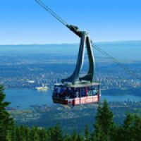
Grouse Mountain
The Grouse Mountain Gondola is an iconic attraction, offering visitors breathtaking views of the city and the surrounding mountains. The gondola takes you on a scenic ride up the mountain to the summit of Grouse Mountain, where you can experience a range of activities, dining options, and panoramic views of the city, mountains, and the Pacific Ocean from various lookout points. You can also enjoy outdoor activities like hiking, zip-lining, or skiing, depending on the season.
Click to find out more
-
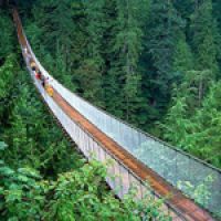
Capilano Suspension Bridge
Get ready to explore a world filled with breathtaking natural beauty, captivating history, and loads of fun activities for the whole family. Cross the awe-inspiring Suspension Bridge, wander through the lush rainforest canopy on the Treetops Adventure, and feel the thrill of walking high above the canyon on the heart-pumping cliffwalk. Capilano Suspension Bridge Park is the top attraction in British Columbia.
Click to find out more
-

Vancouver Aquarium
The Vancouver Aquarium is a large public aquarium located in Stanley Park. It is home to over 50,000 animals from more than 700 species, including marine mammals like beluga whales, sea otters, and dolphins, as well as a variety of fish, invertebrates, and birds. In addition to its exhibits, the Vancouver Aquarium also plays an important role in marine conservation and research. It is involved in a number of initiatives aimed at protecting and preserving marine ecosystems.
Click to find out more
-
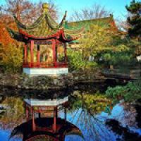
Dr. Sun Yat-Sen Classical Chinese Garden
A sanctuary in the heart of the city, this incredibly manicured garden was the first authentic classical Chinese garden ever built outside of China. Named the World’s Top City Garden by National Geographic, it is the perfect place to visit year-round, with covered walkways and beautiful pavilions.
Click to find out more
-
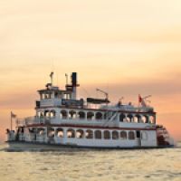
Harbour Cruises & Events
Harbour Cruises & Events provides unparalleled views of Vancouver, and offers a unique and delightful way to experience the city. The company is the only boat sightseeing company in Vancouver to offer regularly scheduled daily and nightly public cruises.
Click to find out more
-
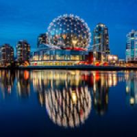
Science World
Ignite your mind and discover the wonders of science with popular, hands on interactive displays, inspirational feature exhibitions, jaw-dropping science demonstrations on Centre Stage, immersive films in the domed OMNIMAX® Theatre and awesome shows in the Science Theatre. This is an engaging experience for the whole family!
Click to find out more
-

Vancouver Art Gallery
The Vancouver Art Gallery is one of the largest art museums in Canada, featuring a diverse collection of over 12,000 works of art from both local and international artists. The museum is located in the heart of downtown Vancouver and offers visitors a unique cultural experience through its exhibitions, educational programs, and public events.
Click to find out more
-
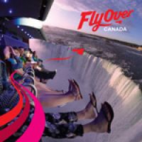
FlyOver Canada
See Canada like never before at Vancouver's new must-see attraction! FlyOver Canada is a breathtaking, all-ages, flight simulation ride like no other. Take off into a huge dome screen with the latest in projection and ride technology creating a true flying experience, complete with wind, scents, and mist!
Click to find out more
-
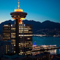
Vancouver Lookout
Located in the downtown Harbour Centre, the Vancouver Lookout, at a height of 130 metres (430 feet), is the perfect place to survey the city and plan, or reflect upon your day.
Click to find out more
-
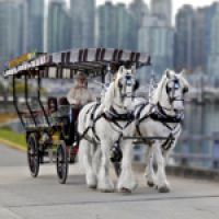
Stanley Park Horse-Drawn Tours
Step aboard one these old-fashioned horse-drawn vehicles and take a relaxing trip through the natural beauty of Stanley Park, one of Vancouver's top attractions.
Click to find out more


Okanagan Falls, Oliver & Osoyoos

Overview of the area
As you drive towards Osoyoos and enter the Thomson-Okanagan region, you'll find yourself in the warmest area of Canada. This region is famous for its majestic lakes, quality wineries, ciders, and fruit production, as well as the scenic ranges of mountains, blue lakes with sandy beaches, pine forests, flower gardens, and vineyards. Penticton, Kelowna, and rural towns of Oliver and Osoyoos are popular cities to visit in this region. The Okanagan and Similkameen valleys, in the south, are known for being one of the warmest places in Canada with over 2000 hours of sunshine every year. The summers are hot, and winters are short and moderate, making it an ideal destination for camping and other outdoor activities.
As you drive towards Osoyoos and enter the Thomson-Okanagan region, you'll find yourself in the warmest area of Canada. This region is famous for its majestic lakes, quality wineries, ciders, and fruit production, as well as the scenic ranges of mountains, blue lakes with sandy beaches, pine forests, flower gardens, and vineyards. Penticton, Kelowna, and rural towns of Oliver and Osoyoos are popular cities to visit in this region. The Okanagan and Similkameen valleys, in the south, are known for being one of the warmest places in Canada with over 2000 hours of sunshine every year. The summers are hot, and winters are short and moderate, making it an ideal destination for camping and other outdoor activities. Osoyoos, a city with only about 6000 inhabitants, becomes a bustling destination for visitors during the summer due to its warm climate. It is known as the warmest city in Canada, with an average temperature of 29 Celsius (84 Fahrenheit) in July. Osoyoos Lake is the warmest lake water in Canada and offers excellent opportunities for water recreational activities, camping, and wine tasting. Despite being in Canada, the region is surprisingly dry and calm, and you'll find the only desert in Canada with all the flora and fauna that you would expect from a desert.
The Okanagan Valley is a desirable destination for its diverse scenery and warm climate. It is great to have so many lakes and beaches nearby to enjoy during the hot summer months. The lakes around Osoyoos are also the warmest in Canada, providing ideal conditions for swimming until late October. Overall, this region offers a unique experience with its warm climate, diverse scenery, and a variety of recreational activities, making it a perfect destination for visitors seeking a memorable experience in Canada.
Campgrounds around Okanagan Falls
-
Okanagan Lake Park Campground
This park offers a perfect combination of sandy and pebbly beaches surrounded by ponderosa pine and sagebrush, making it an ideal destination for swimming and water activities. The two large campgrounds in the park provide panoramic views of the picturesque landscape. Across the lake, visitors can access Okanagan Mountain Park, which offers stunning views from the beach to the skyline and can be reached by boat or by driving back through Kelowna. During the summer season, visitors can enjoy the convenience of a concession located at the south campground gatehouse.
Amenities include 174 reservable frontcountry sites, tables, firepits, showers, drinking water, a playground and boat launch. The proximity to the Highway mean it can be a bit noisy at times.
The campground is open April to mid October.
-
sx̌ʷəx̌ʷnitkʷ (Okanagan Falls) Provincial Park
Okanagan Falls Provincial Park is famous among naturalists for its superb bird watching, wildlife viewing, nature study, photography opportunities and a variety of bats. You can view the bats at twilight. It offers recreation opportunities for nature lovers, campers and fishing enthusiasts alike. The campground is nestled between the foothills of Mt. McLielan and the Okanagan River. Firewood is available for sale.
The campground is open April to mid October.
Campgrounds around Oliver
-
Inkaneep Park
Inkaneep Provincial Park is nestled in tall riverside cottonwoods in a residential area. This park offers wonderful bird watching opportunities. The park is conveniently located just outside of the town of Oliver.
Amenities at Inkaneep Park include pit-toilets, drinking water and firepits.
Despite its small size, this campground is not frequently used and can have availablity even during the peak season.The campground is open mid May to late Septmeber.
-
Gallagher Lake RV Resort
Gallagher Lake RV Resort is nestled in the South Okanagan Valley on a beautiful spring-fed lake. Situated in the only recognized desert area in Canada, the well maintained facilities paired with a private sandy beach and unparalleled weather makes this a vacation destination you won’t want to miss! The resort is open year-round and is located 10 minutes from Oliver, close to both Penticton and Osoyoos.
Only a handful of tent only sites, but plenty of other sites on offer, this is a full-services campground.
The campground is open year round
Campgrounds around Osoyoos
-
sẃiẃs Park Campground (formerly Haynes Point)
sẁiẁs park is proudly managed and operated by the Osoyoos Indian Band. sẁiẁs park is located within the traditional territory of the Osoyoos Indian Band. Since time immemorial, the Osoyoos Indian Band’s Okanagan ancestors have inhabited and cared for the lands and waters within their traditional territory.
With 41 reservable sites, amenities include Tables, firepit, drinking water, pit toilets and a boat launch
The campground is April to early October. All booking are made by BC Parks.
-
NK’MIP RV Park & Campground
Perfectly situated on the shores of Osoyoos Lake at the edge of the Sonora Desert, tucked between lush working vineyards. Amenities are that of a full-service resort, and the prices reflect that.
The campground is open year round.
Princeton & Bromley Rock Provincial Park

Overview of the area
The route connecting Osoyoos and Manning Provincial Park is fantastic. Princeton, situated at the junction of the Tulameen and Similkameen rivers, is a stunning place in the foothills of the Cascade Mountains. If you intend to spend a few days in Princeton, there are numerous hotels and motels available in and around the town.
A noteworthy attraction in the vicinity is Hedley and Bromley Rock. Bromley Rock is situated 21 km east of Princeton and roughly 15 km west of Hedley. The Bromley Rock area is renowned for the massive holes in the rocks located in the Similkameen River, which serve as swimming holes. These can be found mainly between Princeton and Keremeos, with the Bromley Rock Provincial Park being the best area to explore. Another enjoyable activity in Bromley Rock and Hedley is floating down the Similkameen River on an inner tube. However, note that the river can run very fast during certain periods, so it is advisable to check for detailed information at Bromley Rock Provincial Park before jumping in.
Campgrounds around Princeton
-
Bromley Rock Provincial Park Campground
A striking rock bluff along the Similkameen River provides a focus for this tiny park. The campsites are located in a pleasantly-forested site along the Similkameen River. Tubing is also popular here giving a downstream route to Stemwinder Provincial Park. Hiking in the area affords good views of the Similkameen Valley.
Amenities include 17 reservable frontcountry sites, tables, firepits, drinking water and a pit or flush toilets.
The campground is open April to late September.
-
Stemwinder Provincial Park Campground
Stemwinder is a quaint, 3.6 hectare sized park near Hedley. You can find this pine-dotted camping area beside the Similkameen River, just off Highway 3. Anglers like to try their luck from the rock-covered shoreline.
Amenities include 27 reservable frontcountry sites, tables, firepits, drinking water and a pit or flush toilets.
The campground is open April to late September.
Manning Provincial Park

Overview of the area
Manning Provincial Park is a breathtaking destination located in the Cascade Mountains of British Columbia, Canada. The park is named after E. C. Manning, the former Chief Forester of British Columbia, and covers over 70,000 hectares of land. The park boasts a diverse range of flora and fauna, making it a popular destination for nature lovers.
Manning Provincial Park offers a wide range of outdoor activities, including hiking, fishing, camping, and skiing. There are over 200 kilometers of trails throughout the park, ranging from short, easy walks to challenging multi-day hikes. In the winter, the park offers over 50 kilometers of cross-country skiing trails and a downhill ski area.
The park features nine front-country campgrounds with over 450 sites, and there are also numerous day-use areas with picnic tables and shelters and even more back-country campsites accesible only by hiking in. Visitors can enjoy a variety of lakes, rivers, and waterfalls, including the stunning Lightning Lake, which is a popular spot for swimming and boating.
Overall, Manning Provincial Park is a must-see destination for anyone who loves the outdoors and wants to experience the natural beauty of British Columbia.
Campgrounds in Manning Provincial Park
-
ALL Manning Provincial Park Campgrounds
Nine drive-in campgrounds offer vehicle-accessible camping and there are also opportunities for backcountry camping.
The front-country, vehicle accessible campgrounds include 373 reservable frontcountry sites, with an additional 77 vehicle accessible, first come, first serve sites.
Amenities for the major campgrounds include: picnic tables, firepits, showers, drinking water, sani-station for RVs, playgrounds and a boat launch.
Here is a list of the front-country, vehicle accessible campgrounds:
- Lightning Lake Campground (Large Loop)
- Lightning Lake Campground (Small Loop)
- Hampton Campground
- Coldspring Campground
- Mule Deer Campground
- Skyview RV Campground
- Lone Duck groupsite 1 (Tent Only)
- Lone Duck groupsite 2 (Tent Only)
- Cambie Creek groupsite 3 (Tent Only)
Most campgrounds are open May to October. The BC Parks website has even more location specific information.
Sunshine Coast - Powell River & Lund

A ferry crossing from Horseshoe Bay to Langdale and a quick drive will bring you to the Sechelt. Another ferry crossing from Earls Cove to Saltery Bay and a scenic drive will bring you all the way to Powell River and Lund.
Lund and Powell River
The Lund and Powell River area is a stunning region located on the Sunshine Coast of British Columbia, Canada. The region boasts breathtaking landscapes, crystal-clear waters, and a rich cultural heritage that draws visitors from around the world.
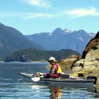
Lund is a picturesque coastal village that serves as the gateway to Desolation Sound Marine Park, one of the most popular marine parks in British Columbia. Visitors to Lund can enjoy a wide range of outdoor activities, including kayaking, canoeing, boating, fishing, and hiking. The area is also known for its incredible wildlife, including bears, whales, and eagles. Fun fact: Lund is located at "Mile 0" of the world's longest highway, the Pan-American (also known as Highway 101 in parts of the United States and Canada). The highway stretches 15,020 km (9,312 miles) from Lund, BC to Castro on Chile's south coast.
Powell River is a vibrant community located just a short distance from Lund. The town is situated on the shores of the Strait of Georgia and offers visitors a wide range of attractions and activities. Some of the most popular activities in Powell River include fishing, boating, swimming, and hiking. The town is also home to a number of cultural institutions, including the Powell River Historical Museum and Archives, the Powell River Public Library, and the Powell River Academy of Music.
The area is also famous for its many parks and natural attractions. The Sunshine Coast Trail is a 180-kilometer hiking trail that winds through the heart of the region, offering visitors unparalleled views of the coast and the surrounding mountains. The region is also home to a number of other parks, including Inland Lake Provincial Park and Okeover Arm Provincial Park.
To sum it up, the Lund and Powell River area is a must-see destination for anyone who loves the outdoors, culture, and natural beauty. With its incredible scenery, endless activities, and rich cultural heritage, this region is sure to leave a lasting impression on visitors.
Campgrounds around Lund and Powell River
-
Okeover Arm Park Campground
On the east side of the Malaspina Peninsula, visitors can enjoy canoeing, kayaking, and exploring the diverse marine life, as well as walking through the lightly forested upland area. This small campground is located near the entrance of Desolation Sound Marine Park and features 14 vehicle/tent sites that are open seasonally, and four small, condensed sites that are open year-round. Activities available include swimming, fishing, and canoeing/kayaking. The campsites are nestled among mature hemlock and cedar trees, with space for two vehicles at each site, and extra parking available for campers only.
Amenities at this campground include 14 vehicle accessible campsites, four tent-only sites, picnic tables, pit toilets, drinking water, fire pits, and a boat launch.
The campground is open year-round, and operates on a first-come, first-served basis, with no advance reservations available. For more information on this location, visitors can consult the BC Parks website.
-
Inland Lake Campground
This park offers 22 vehicle-accessible campsites. There are no double or pull-through sites available. Camping is under canopy of trees. There is no gatehouse or locked gate. There is room for one vehicle at each site and extra parking is available for a fee. Activities available include swimming, fishing, and canoeing/kayaking.
Amenities at this campground include 22 vehicle accessible campsites, 15 of which are reservable, picnic tables, pit toilets, drinking water, fire pits, and a boat launch.
The campground is mid May to mid September. For more information and reservations, please visit the BC Parks website.
-
Willingdon Beach Campsite
Nestled in the heart of Powell River and situated along the shoreline, the Willingdon Beach Campsite is a family-friendly private campground that is open year-round. The campground is located adjacent to the Willingdon Beach, which features two new playgrounds, a spray park, beach volleyball courts, and a sandy beach that is perfect for swimming or relaxing on shore. Additionally, it is across the street from a mini-golf course and is in close proximity to the city's Recreation Complex, museum, boat launch, breakwater, hiking trails, and other natural attractions.
Amenities at the campground include 83 sites that are suitable for full hook-up, electric/water, tenting, and unserviced sites. Other amenities include picnic tables, shower/toilet facilities, drinking water, fire pits, and laundry facilities.
The Campground is open year-round. For more information and reservations, please visit the Willingdon Beach Campsite website.
Things to do and see in around Lund and Powell River on the Sunshine Coast
-
Unique Kayak Tours by Footprint BC
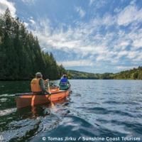
Sea kayaking is a fantastic way to explore two of British Columbia's most unique and scenic destinations: Desolation Sound Marine Park and Copeland Islands Marine Park. You'll have the opportunity to meet curious seals, playful river otters, and sometimes even impressive sea lions. With a bit of luck, you might encounter a pod of orcas or a humpback whale in Desolation Sound or the Salish Sea.
Click to find out more
-
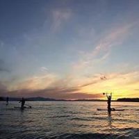
Rent a standup paddle board (SUP), or take a tour
The Sunshine Coast is renowned for its breathtaking sunsets and vibrant coastlines teeming with life. We believe there's no better place to experience this than from the water itself!
Click to find out more
-
Visit Inland Lake Provincial Park
Inland Lake Provincial Park is a hidden gem that offers visitors a unique blend of natural beauty, recreational activities, and opportunities for relaxation.
The park's centerpiece is Inland Lake, a pristine freshwater lake surrounded by lush forests and rolling hills. The lake's calm waters are ideal for canoeing, kayaking, and swimming, while its shoreline provides ample opportunities for picnicking and sunbathing.
Click to find out more
-
Visit Willingdon Beach in Powell River
Willingdon Beach features a stretch of fine, golden sand that is ideal for sunbathing, beachcombing, and building sandcastles. Its calm waters provide a safe environment for swimming and wading, making it an excellent choice for families with young children. The nearby grassy areas and picnic tables allow visitors to enjoy outdoor meals while taking in the stunning ocean views.
Click to find out more
-
Hike a section of the legendary Sunshine Coast Trail
Explore the 5.6-kilometer out-and-back trail near Powell River, British Columbia. Typically regarded as a moderately challenging route, it takes an average of 2 hours and 3 minutes to complete. This trail is popular for backpacking, camping, and hiking, but tranquility can be found during less busy times of the day. The optimal months to visit this trail are from April to October.
Click to find out more


Sunshine Coast - Sechelt & surrounding parks

Departing from Powell River, a ferry crossing from Saltery Bay to Earls Cove, followed by a picturesque drive, will lead you to Sechelt.
Skookum Chuck Narrows Provincial Park
Skookumchuck Narrows Provincial Park is a captivating and unique natural attraction situated just east of Earls Cove, BC. This 185-hectare park is famous for its remarkable tidal rapids, where the powerful tidal currents create intense whirlpools and standing waves.
The park's main feature is the Skookumchuck Narrows, a narrow passage where the waters of Sechelt Inlet and Jervis Inlet converge. As the tide changes, billions of liters of water are forced through the narrows, creating one of the fastest tidal currents in the world, with speeds reaching up to 30 kilometers per hour.
Visitors to the park can witness this extraordinary natural phenomenon from various viewpoints along the Skookumchuck Narrows Trail, a moderate 4-kilometer hike through lush coastal rainforest. The trail offers a serene and picturesque walk, with opportunities to observe diverse flora and fauna, including bald eagles, seals, and other wildlife.
In addition to the tidal rapids, Skookumchuck Narrows Provincial Park is an excellent destination for outdoor enthusiasts who enjoy hiking, birdwatching, and photography. The park's tranquil setting and stunning natural beauty make it a must-visit attraction for those exploring British Columbia's Sunshine Coast.
Smuggler Cove Provincial Park
Smuggler Cove Provincial Park is a picturesque and secluded marine park located on the Sunshine Coast, 16 km West of Sechelt. Encompassing 185 hectares of land and water, this park is known for its beautiful coastal scenery, sheltered anchorage, and diverse wildlife.
One of the main attractions of Smuggler Cove is the series of interconnected bays and inlets that offer excellent opportunities for kayaking, canoeing, and boating. The calm waters and protected coves create a serene environment for exploring the park's rugged shoreline and rocky islets.
For those who prefer land-based activities, the park features a well-maintained, 4-kilometer round-trip hiking trail that meanders through lush coastal rainforest and skirts along the water's edge. The trail leads to several lookout points that provide stunning views of the cove and its surrounding natural beauty.
Smuggler Cove is home to a diverse array of wildlife, including various bird species, seals, sea stars, and other marine life. The park's pristine habitats make it an ideal location for birdwatching and wildlife observation. Additionally, the park offers limited walk-in campsites for visitors looking to spend the night immersed in this tranquil coastal setting.
Sechelt, BC
Sechelt, BC, is a picturesque coastal town located on British Columbia's Sunshine Coast, nestled between the Pacific Ocean and the rugged Coast Mountains. Known for its stunning natural beauty, mild climate, and vibrant arts scene, Sechelt offers a perfect blend of outdoor adventures, cultural experiences, and relaxation.
The town's location on the Sunshine Coast makes it a popular destination for water-based activities, such as kayaking, sailing, swimming, and fishing. Visitors can explore Sechelt's scenic coastline, dotted with tranquil bays, inlets, and marine parks, including Smuggler Cove and Skookumchuck Narrows Provincial Park.
Sechelt is surrounded by lush forests and mountainous terrain, providing abundant opportunities for hiking, mountain biking, and wildlife watching. Trails such as the Sechelt Heritage Hidden Groves and Tetrahedron Provincial Park cater to varying levels of fitness and experience, offering picturesque views and a chance to connect with nature.
The town is also renowned for its thriving arts and culture scene. Sechelt is home to numerous galleries, studios, and workshops, where visitors can discover local artists' work and participate in various events and festivals throughout the year. The Sechelt Arts Festival and the Sunshine Coast Festival of the Written Arts are just a few examples of the town's commitment to celebrating the arts.
In addition to its natural and cultural attractions, Sechelt offers a range of amenities, including shops, restaurants, and accommodations, catering to various tastes and budgets. The town's welcoming atmosphere and laid-back lifestyle make it an ideal destination for travelers seeking a memorable and relaxing getaway.
Campgrounds around Sechelt
-
Porpoise Bay Campground
Porpoise Bay Park on the Sunshine Coast offers many opportunities for coastal fun and is a favourite family park. The park is separated from the Strait of Georgia by the isthmus at Sechelt. It is characterized by second-growth forest, open grassy areas, and sandy beaches. Porpoise Bay Park also makes an excellent basecamp for paddlers exploring the Sechelt Inlet.
Amenities at this campground include 84 vehicle accessible campsites, 10 tent-only walk-in sites, picnic tables, pit or flush toilets, drinking water, fire pits, showers, a playgorund and easy access to the inlet.
The campground is open early April to mid October, and reservations are available on the BC Parks website.
-
Roberts Creek Campground
Roberts Creek Campground is a charming and tranquil camping destination located near Sechelt on British Columbia's beautiful Sunshine Coast. Surrounded by lush forests and offering easy access to the beach, this campground is an ideal spot for visitors seeking a peaceful retreat with ocean views. The surrounding area offers a range of outdoor activities, including hiking, mountain biking, and wildlife watching. The scenic Roberts Creek Provincial Park and Cliff Gilker Park provide well-maintained trail networks through lush coastal rainforests, allowing visitors to explore the region's diverse flora and fauna.
Amenities at this campground include 21 vehicle accessible (gravel)campsites, picnic tables, pit or flush toilets, drinking water, fire pits, and easy access to the beach.
The campground is open year-round on a first-come, first-served basis. Learn more on the BC Parks website.


